Home
World
NEW
Premium
Shop
Trails
Articles
Help and support
Français
English
Nederlands
Español
Italiano
Deutsch
Log in
Home
World
Premium
Shop
Trails
Articles
Help and support
SityTrail
>
Points of interest
>
GCGEBF
SityTrail
>
Points of interest
>
GCGEBF
GCGEBF
Description
col de fours - HCTs highest by
Photos
GCGEBF can be discovered in the following trails...
tracegps
Le Fort de la Batterie
Walking
Medium
Marthod, Auvergne-Rhône-Alpes, Savoy, France
6.5 km | 13.3 km-effort
2h 30min
Yes
tracegps
User
©
OpenStreetMap
contributors
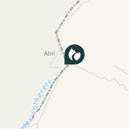
Positioning
Country:
France
Region :
Auvergne-Rhône-Alpes
Department/Province :
Upper Savoy
Municipality :
Les Contamines-Montjoie
Location:
Unknown
Positioning
45.731333 / 6.723633
Creation date :
2018-04-09 12:16:24.011
Updated on
2018-04-09 12:16:24.011
(0 Reviews)
Comments
Please log in to post a review or rate the element
Points of interest nearby
tracegps
GCGEBF
LES CONTAMINES-MONTJOIE
tracegps
GCGEBF
LES CONTAMINES-MONTJOIE
tracegps
GCGEBF
LES CONTAMINES-MONTJOIE
tracegps
GCGEBF
LES CONTAMINES-MONTJOIE
tracegps
GCGEBF
LES CONTAMINES-MONTJOIE
tracegps
GCGEBF
LES CONTAMINES-MONTJOIE
tracegps
GCGEBF
LES CONTAMINES-MONTJOIE
tracegps
GCGEBF
LES CONTAMINES-MONTJOIE
Close
My subscriptions